Turn scans into maps
Georeferencer is an online tool that assigns geographical location to any image.
How does it work?
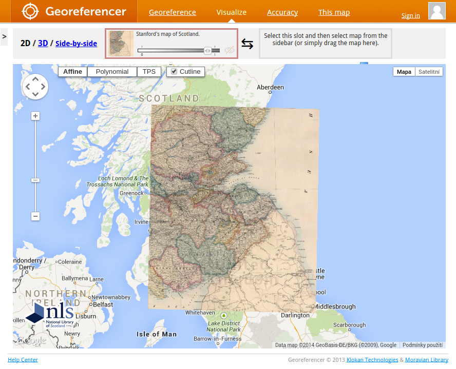
Old map ond the left side, up-to date online map on the right side. Just find at least three same places on both maps and you can overlay the old map over the modern maps or compare them side-by-side.
Via crowdsourcing, invite colleagues or the general public to help your institution with locating of digital map collections. Hundreds and thousands of maps can be processed and located within days or weeks and collected coordinates will enrich your existing bibliographic records.
Standardized Web Map Tile Service (OGC WMTS) is delivered immediately to all users.
Institutions using Georeferencer
Large collections of scanned images have been successfully georeferenced in crowdsourcing pilots of our customers.
Click to explore pilots:
Requirements
The only requirement is to have the maps accesible online, with a viewer that supports IIIF standard. If not, a reliable hosting with an easy ftp upload can be provided by Klokan Technologies. More information about hosting of maps is available at Cultural heritage page.
When the images are online, a spreadsheet with links to the maps and catalogue records is required for the initial import. Please see the documentation and a sample spreadsheet at: http://help.georeferencer.com/metadata.
Before the order, please make sure you are absolutely clear in these 2 values:
- Amount of maps (total number)
- Size of the maps (total in GB)
Implementation
A new Georeferencer project comes in following steps:
- Order and payment (credit card/PayPal/wire transfer)
- FTP access* (we send a login and password)
- Upload of images* (you upload the images to our server)
- Spreadsheet (submit us your valid spreadsheet)
- Design requirements* (default in orange colour)
- Conversion of maps to IIIF format (our turn, approx 1 week)
- Voilà. Ready to start georeferencing!
Deliverables are available at http://start.georeferencer.com/test/ (you will receive a similar page after we finish the import of your maps). Use the widgets as they are or modify create another visualisations from the linked Fusion Tables data. All your data (including MARC 034 export) can be extracted from the Fusion Tables.

Old maps online
The names of places change with time, the geographical position does not. Time efficiency is the greatest advantage of geographical search.
Search for any place at www.oldmapsonline.org to visit half-a-million maps from different world archives. All maps processed with Georeferencer can be easily added into OldMapsOnline website and mobile app and bring more visitors to your collections.
Pricing
There is a fee for initial setup and then a maintenance fee for each year running the service, which is according to the number of maps that you use, please see the pricelist. For any information regarding implementation of Georeferencer for your organization, please contact us.


